![Item #44575 [Map] Baltic Sea. John Rapkin, John Tallis.](https://kaaterskillbooks.cdn.bibliopolis.com/pictures/44575.jpg?width=768&height=1000&fit=bounds&auto=webp&v=1591211713)
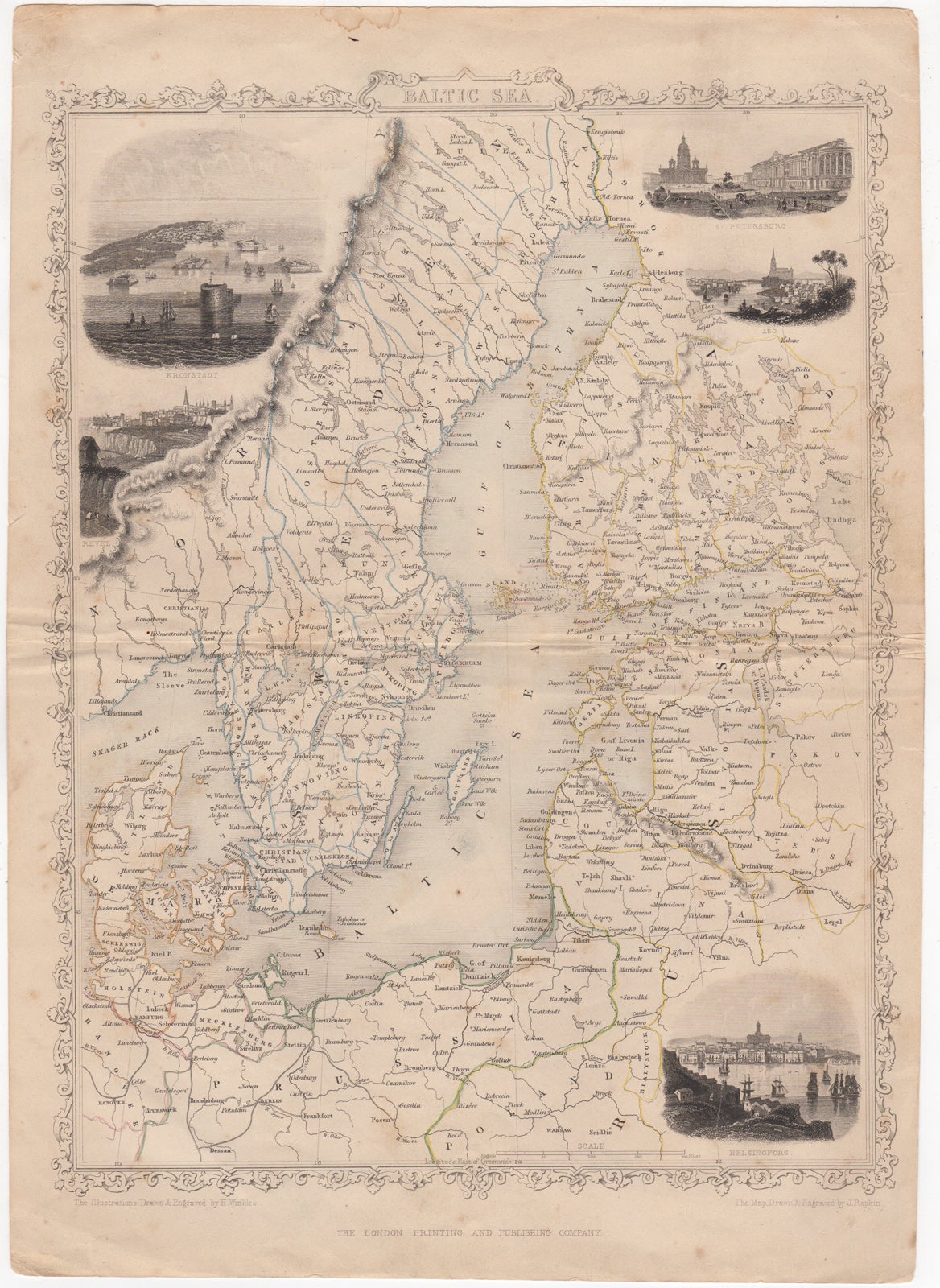
[Map] Baltic Sea.
London: London Printing and Publishing Company, [ca. 1853]. 1 sheet, folded. 27 x 37 .5 cm. Engraved map, outlined in color, with five engraved vignettes. 27 x 37.5 cm. Very good, edge worn, few marginal tears, faint soiling. Item #44575
Contains decorated border. Illustrations drawn & engraved by H. Winkles, and depict Kronstadt, Revel, St. Petersburg, Abo, and Helsingfors. Taken from Tallis' "Illustrated Atlas and Modern History of the World" or "The Illustrated War with Russia", after he formed a partnership with Ephraim Tipton Brain in 1853, as the London Publishing Company.
Price: $50.00
See all items in
Maps
See all items by John Rapkin, John Tallis