![Item #41243 [Map] A New and Accurate Map of Peru and the Country of the Amazones. Drawn from the most authentick French maps &c. and regulated by astronomical observations. Emanuel Bowen.](https://kaaterskillbooks.cdn.bibliopolis.com/pictures/41243.jpg?width=768&height=1000&fit=bounds&auto=webp&v=1432524618)
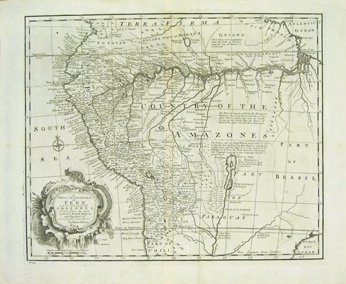
[Map] A New and Accurate Map of Peru and the Country of the Amazones. Drawn from the most authentick French maps &c. and regulated by astronomical observations.
[London]: William Innys [et al.], 1747. 42.5 x 35.5 cm. (16.75 x 14 inches). A very good copy. Item #41243
No. 55. An excellently detailed copper engraved map with much information on Peru, showing the course of the Amazon River, providing great detail along the coast from Ecuador to Chile, highlighting gold and silver deposits, and including a number of mythical locations. From Bowen "A Complete System of Geography," 1747.
Price: $325.00
See all items in
Latin America,
South America
See all items by Emanuel Bowen