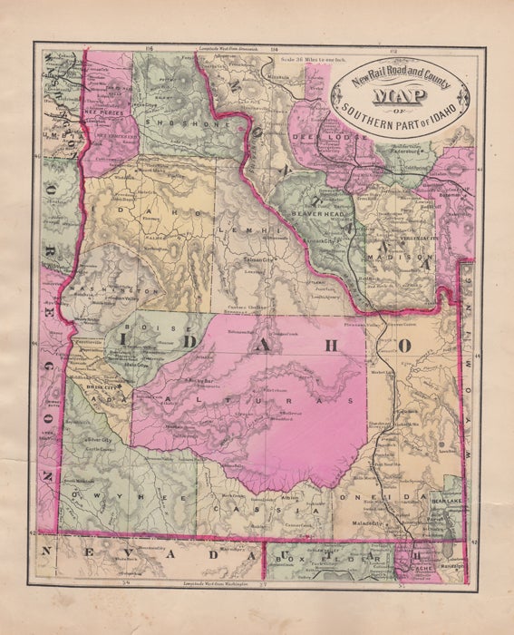
New Rail Road and County Map of Southern Part of Idaho.
[Chicago]: George F. Cram, [ca. 1882]. One sheet (30 x 35 cm). 29 x 24 cm. (11 1/2 x 9 1/2 inches). Light foxing, finger soiling, and small tears in the margins, old horizontal tear about two inches up from lower edge, with old tape repairs on the verso. Still good. We have a very good copy but with a slightly lighter machine coloring. Phillips 901. Item #43519
Hand colored. Title inside oval cartouche. Scale 36 miles to 1 inch. Taken from "Cram's Illustrated Family Atlas of the World." There were numerous versions of the New Rail Road and County maps by published by Cram and Henry S. Stebbins, with later versions machine colored due to the expense of hand coloring.
Price: $50.00