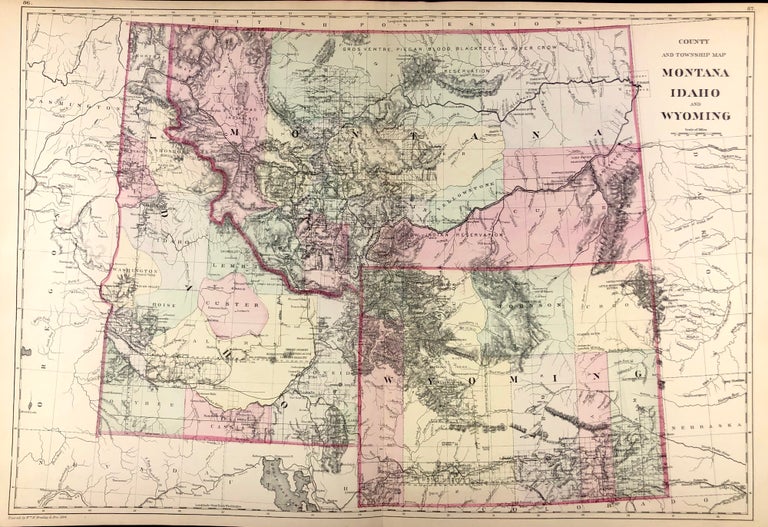
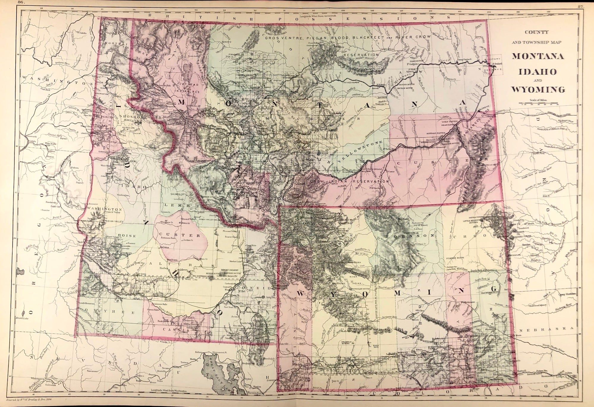
County & Township Map Montana, Idaho, and Wyoming.
[Philadelphia]: [W.M. Bradley & Bro.], 1886. Hand colored map. 21 x 14.5 inches. Very good, faint toning. Item #45721
Plates 86 & 87: County & Township Map Montana, Idaho, and Wyoming. Entered by Wm. M. Bradley & Bro. 1884.
From: Mitchell's New General Atlas, Containing Maps Of The Various Countries Of The World, Plans Of Cities, Etc., Embraced In Ninety-Three Quarto Maps, Forming A Series Of One Hundred and Forty-seven Maps and Plans, Together With Valuable Statistical Tables. Also, A List Of Post-Offices Of The United States And Territories, And Also Census Of 1880 For States, Territories And Counties, Also Of Cities Of Over 10,000 Inhabitants. Philadelphia: Published By Wm. M. Bradley & Bro., No. 1026 Arch Street. 1886.
Price: $100.00