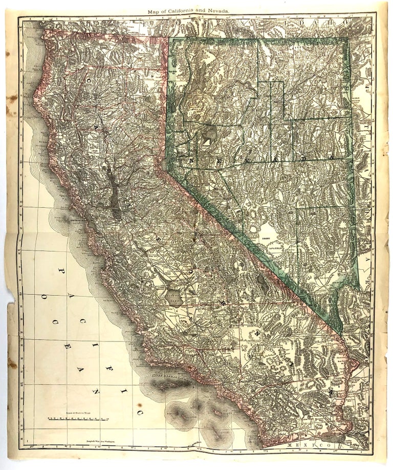
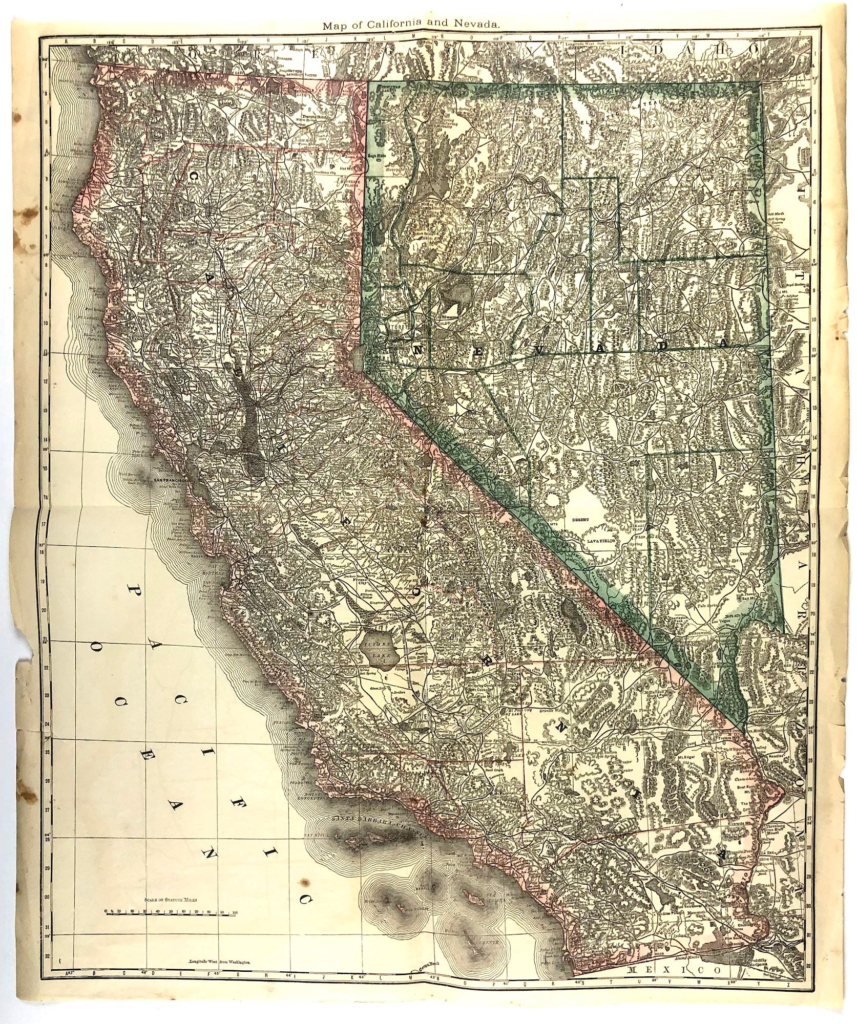
Map of California and Nevada.
[Chicago]: [Rand McNally], [1881]. Image size 23.5 x 19.14 inches on 24.5 x 20.5 sheet. A very good copy, some edge tears, one closed tear about 1/2 inch into blank area of map, one small hole at fold, generous margins. Item #46231
Outlined color. Relief shown by hachures and spot heights. An extremely detailed, if not the most detailed map of California and Nevada up to that time to be published in an Atlas. Shown are many hundreds of natural and man-made features such as mountains, rivers, lakes, springs, wells, lava fields, deserts, plains, craters, dry lakes, passes, as well as military encampments, mines, Native American Reservations, roads, railroads and stations, canals, ferry crossings, Missions, cities, towns, and other human habitations, many of which are long gone. Removed from the Rand McNally's Indexed Atlas of the World, first edition, 1881.
Price: $250.00