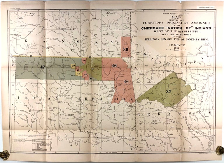
Map showing the territory originally assigned to the Cherokee "Nation of" Indians west of the Mississippi (1884).
Washington, D.C. N. Peters, Photo-Lithographer, 1884. 30 x 21.5 inches. A very good copy, a few marginal tears, tiny tears at three folds. Item #46234
Detailed color map of the regions intended for the post-Removal Cherokee and later divided among a number of tribes relocated to what would become eastern Oklahoma. Includes "Numeric and chronological schedule of Cherokee cessions" beginning in 1828. Shows Indian settlements, military forts, tribal agencies, council houses and grounds, the Cherokee capital of Tahlequah, and the original Cherokee treaty land in northern Arkansas, including the "Old Cherokee Village" and "Old Cherokee Agency Reservation." The map appeared in the 5th Annual Report of the Bureau of Ethnology to the Secretary of the Smithsonian Institution. See TVA Map Collection.
Price: $150.00

